Cape Town Inequality
Void Infrastructures and Lived Responses
Harvard GSD Studio, fall 2022
Cape Town, South Africa
Team: Jonathan Cook, Aziz Alshayeb, Cindy Yiin, Keana Flores, Tong Lin, Pinyan Chen
Instructors: Heinrich & Ilze Wolff
Simulating designers and planners advising the City of Cape Town, this highly collaborative studio created a strategic framework to facilitate rapid urbanization resulting from a land grab of publicly-owned land, an urban golf course. Rather than proposing an aesthetic “solution” to a systemic problem, this framework empowers residents to improve their situations despite a context of ethnic and economic segregation, distrust of government, racial capitalism, and intransigent governance.
Present Situation
Learning Through Reenactment
Urbanization Framework
Preemptive Framework
Concurrent Framework
Iterations of Incrementality
Similarities to Existing Townships
Site-Specific Redevelopment
Outline:
The Present Situation
Governing decisions of the City of Cape Town are corrupt, lack creativity, and are not rapid enough to support the population’s needs. An alternative is required.
When two disparate urbanization patterns exist next to each other, they indicate severe segregation in the society, here a result of a century of apartheid manifesting both physical and non-physical “void infrastructures.” However, the creativity of residents under such systems is remarkable and worth encouraging. These are the “lived responses.”
Langa Township in Cape Town
Learning through Reenactment
From the studio brief, “For urban designers to have any impact on a society where land grabbing is prevalent [and] citizens are mostly building the city for themselves, we need to practice our craft through reenactments as much as through engagement.”
Here, half of the class acted as residents rapidly building housing, while the other half acted as civic leaders and designers ‘managing’ growth.
URBANIZATION FRAMEWORK
After many iterations, a general framework emerged for appropriate city involvement within this delicate process of urbanization. One version assumes early action in a “Preemptive Framework” and the other assumes gentle re-blocking in an existing township as a “Concurrent Framework.”
Preemptive Framework
Town Hall Meeting
Enumerate and coordinate with populations served to understand quantity, locations, cultures, etc. This can occur concurrently with the remaining framework.
1
Site Analysis
Rapidly identify site access points, existing pathways, contours, surface drainage, vegetation, floodplains, etc. Formal surveys may not be required, as they may slow the process.
2
Pinpoint Survey
Locate future roads but intentionally minimize environmental impacts. Keep block sizes to a minimum, but understand which streets need to accommodate higher traffic volumes (vehicles and pedestrians).
3
Rapid-Response Utilities
Deploy necessary but temporary utilities on site, including water trucks, portable toilets, and trash dumpster clusters, each in easily serviceable locations.
4
Tents
Erect large tents in key locations to act as civic anchor points and community resources. Their uses are to change and adapt to the needs of the community over time.
5
Clustering
As urbanization occurs, clusters of houses, pathways, and courtyards are not preemptively located but rather coordinated with people as they choose to build.
6
Landscapes
Parks and gardens are developed over time, with productive landscapes located in floodplains, to prevent the construction of spontaneous housing in dangerous locations.
7
Concurrent Framework
Town Hall Meeting
Begin enumeration and collectively learn about the framework elements. Decide which roads need to be strengthened and which structures may be affected (keeping drainage and fire breaks in mind).
1
Site Analysis
With the town hall meeting, identify existing patterns, contours, and any dangerous conditions. Conduct aerial drone imagery to rapidly identify existing lived responses to the site.
2
Tents
Deploy tents where possible to facilitate community gatherings and resource distribution. These become amenities that change over time based on community need.
3
Re-blocking begins: Pinpoint Survey
Starting nearest to the site access points, identify structures that will be impacted by wider pathways to accommodate fire truck assess.
4
Rapid-Response Utilities
Deploy utilities incrementally for water, sewer, and sanitation. Initially these can be temporary systems for rapid deployment (water trucks, portable toilets, etc.)
5
Clustering
Densify around yards and passageways, moving shacks from floodplains and impacted roadways upon agreement and coordination with residents. Each relocated structure is granted land tenure.
6
Landscapes
Land in environmentally vulnerable areas are designated as productive landscapes to facilitate agriculture, but protect against danger (i.e. flood or fire).
7
Re-blocking completes
Re-blocked areas now have safer streets that facilitate community activity and development while also providing means of engaging in the current system of real-estate via land tenure. This provides a mechanism to escape poverty and build communal wealth.
8
Although the aesthetic of the urbanization frameworks may not appear innovative, they are to initiate internal changes over time while maximizing the impact of limited governmental resources. We hope that the infrastructures created by the frameworks produce a self-improving economic system for each resident's future, resulting in the breakdown of the lasting effects of apartheid.
Similarities to Existing Townships
Incrementality in Iterations
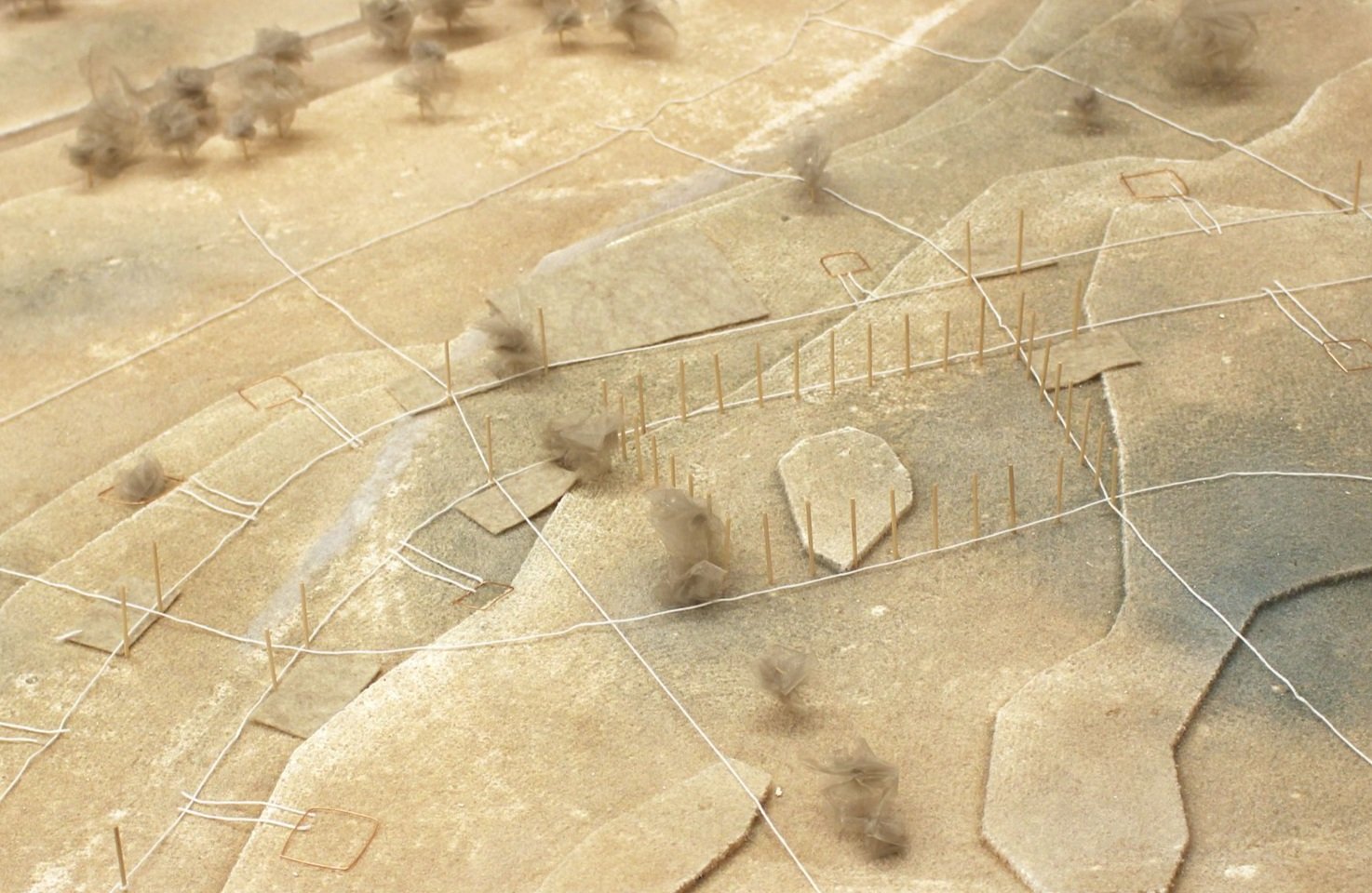
Simulating time is a significant challenge. To illustrate how small details can significantly affect urbanization and building typologies, small detailed models were built and animated. These show utilities being dug, homes being repaired, cooperation between neighbors, and change of use over time.
Detailed models (both 1 and 2) built and animated by Aziz Alshayeb and Tong Lin
Site-specific Redevelopment
Using an existing golf course to explore the potential of the researched material, the plan above represents one possible redevelopment. A key safety strategy to prevent housing from being built in dangerous flood plains is to designate that land as a productive landscape for community use. Also, the incredible existing trees within the golf course can be maintained and utilized as way-finding features by allowing pathways within them. Part of the golf course can be maintained to link the current use to the new community by integrating its “rough” areas into cultivated garden sites. Simultaneously, most of the wasteful open turf can be redeveloped into an urban environment.
More information available upon request:


